
HOME TRAVEL LOG MOUNTAIN BIKING WINDSURFING STORY ARCHIVES RV INFO PHOTOS CONTACT US
HOME
TRAVEL LOG
MOUNTAIN BIKING
WINDSURFING
STORY ARCHIVES
RV INFO
PHOTOS
CONTACT US
< previous story home next story >
February 23 thru March 13, 2009
I got so busy riding back in March that I fell behind on my
documentation (ahem, priorities) but lucky for you, our recent
cross-country drive (we're now in Georgia) gave me several free hours to
write up my rides all around the Phoenix area last month, so clip-in and
enjoy a good long spin on yer screen...
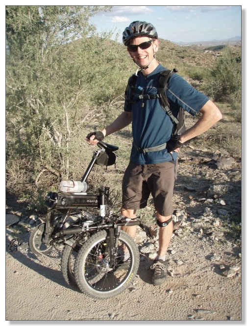
As you may recall from
my
last big post on mtbr, my introduction to Arizona riding came in the
form of the Quadruple Bypass. "Ouch!", sure, but it did make for one
heck of a folding-bike adventure. After winning that day-long battle to keep
the wee wheels rolling through endless stretches of loose rubble and
painfully steep terrain (rather aptly described on mtbr recently as "the
ultimate XC beatdown"), I was definitely in the mood to find some nice
groomed trails and "recover" for a while. So we fired up the motorhome, and
moved from Scottsdale around to McDowell Regional Mountain Park on the other
side of the mountains for about a week.
McDowell Mountain Park
This is one of those great places where the trails start right from the
campground, making it wonderfully easy to bounce back and forth between work
and play. Clean, nice, warm showers next door didn't hurt matters any
either. Definitely a nice campground:
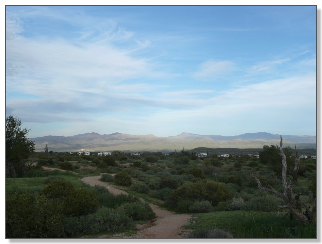
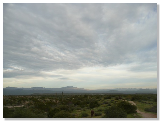
Big, dramatic skies over the desert:
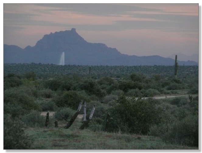
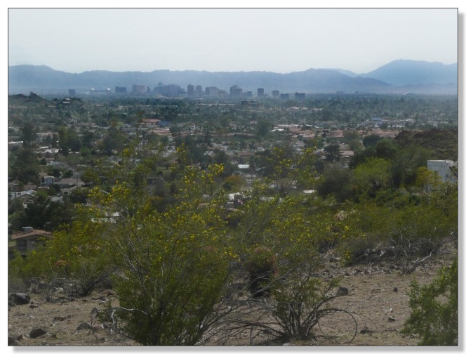
From certain vantage points, the improbably enormous fountain many miles
away in the (aptly-named) town of Fountain Hills came into view:
There's a bit of mountain-biking slang that certain trails should be rated
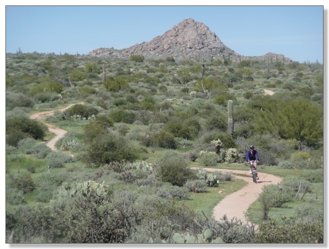
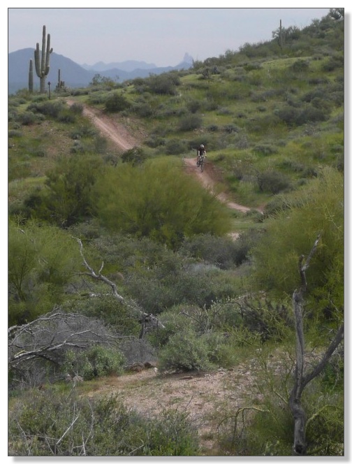
"ADA"--so wide and smooth you could ride a wheelchair on 'em. Well, that
could apply literally to a lot of the singletrack at McDowell:
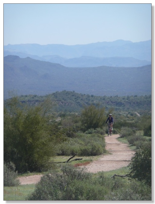
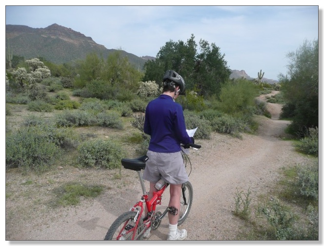
Debbie joined me on several outings. It's always nice to discover a place
where we can ride together. We eventually covered all of the upper trails,
including Pemberton, Granite, Bluff, and Tonto Tank:
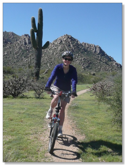
Debbie's not exactly a technical riding enthusiast, but even she found
herself seeking out rocks and waterbars to add some challenge to these
trails. Pretty scenery and fine weather, though:
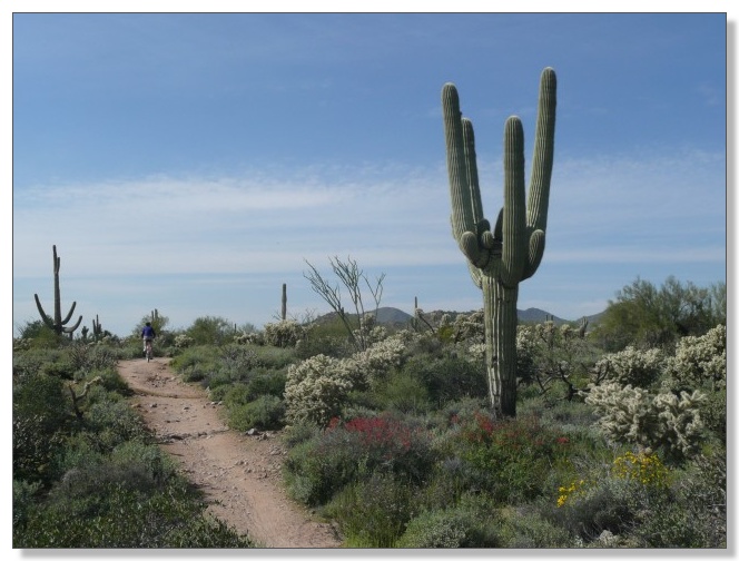
Springtime made the desert turn green like a golf course:
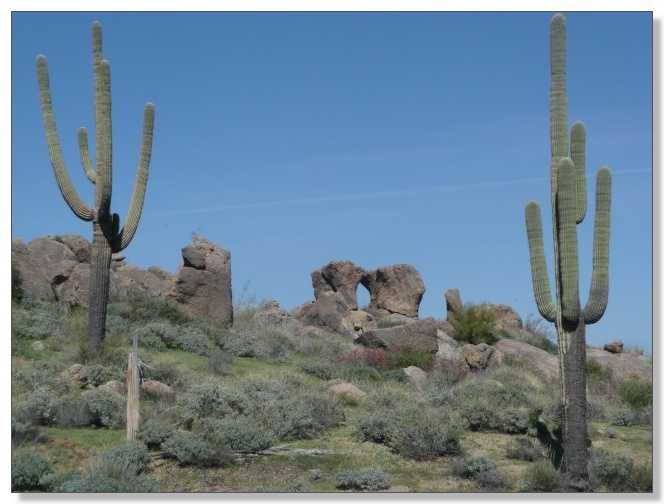
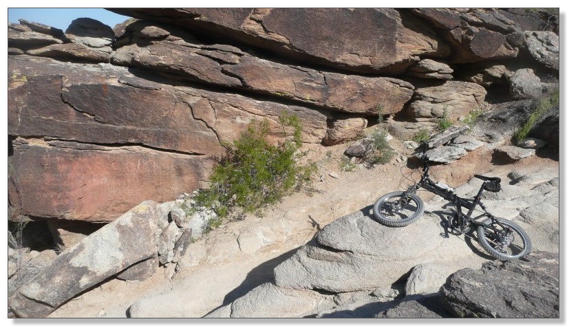
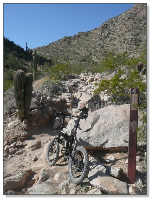
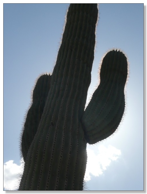
A matched pair of saguaros, and some kissing-cousin rocks:
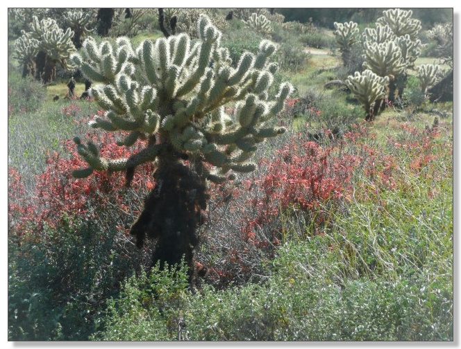
Glistening chollas with red accent foliage:
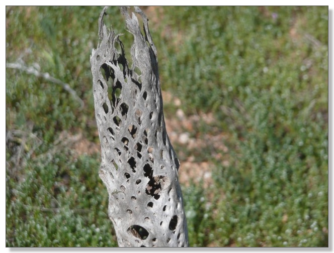
These tubes looked to me like nature's attempt at making a carbon--fiber
seatpost:
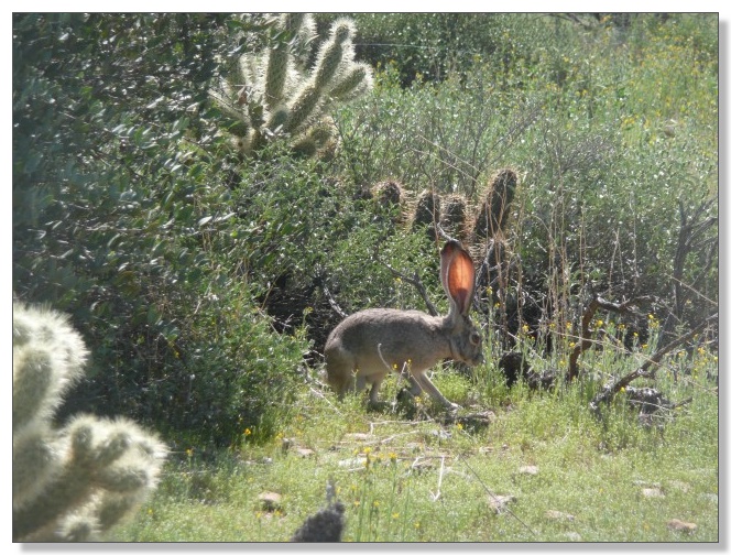
Big-eared bunnies were hopping around everywhere, ears aglow:
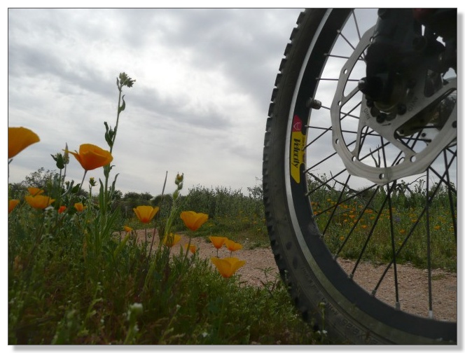
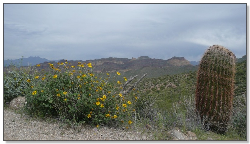
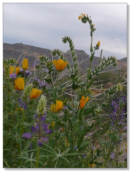
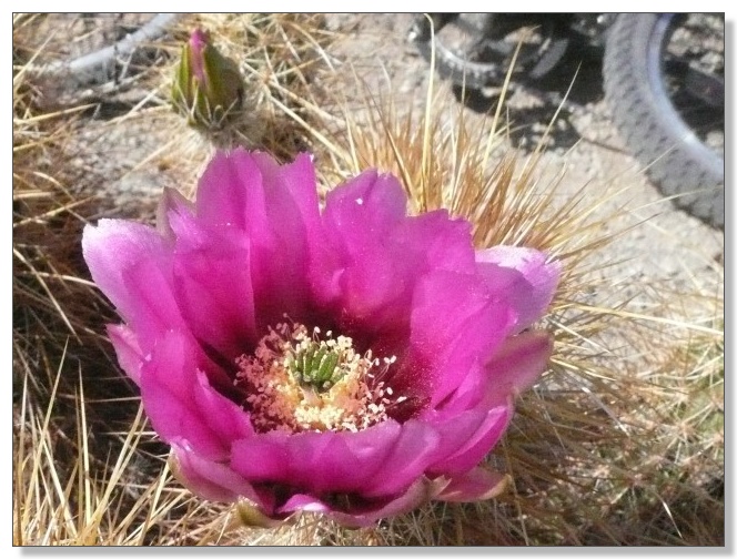
The desert flowers were highly scenic too:
Speaking of things scenic, one trail that was significantly different from
the rest at McDowell was the so-called "Scenic Loop". I hadn't done much
research about these trails and mostly just rode at random, but I'm pretty
sure the Scenic Loop would be more fun clockwise. I concluded that after
riding it counterclockwise, a direction which started out with a long
descent on an ADA trail, and looped back with a long climb on a nasty, loose
rocky singletrack that would surely have been a better descent. Nothing
special either way, really, but worth a shot if you're looking for a "hard"
trail in McDowell park proper.
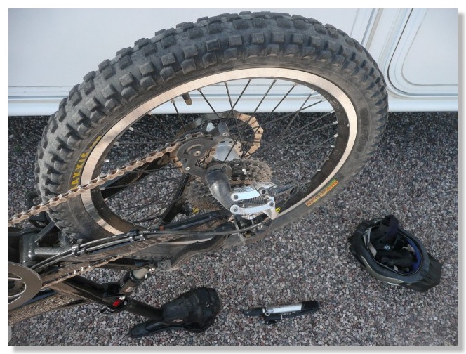
One afternoon I got a slow flat and nursed it back to the RV. This turned
out to be my first and only flat during my first three weeks of riding in
Arizona. Not bad. I did later get three more flats during my final two
weeks. Still, given that I'm running only liner strips and no tubeless or
Slime, I was dreading getting flats constantly with all the cactus and sharp
rocks around, so I can live with 4 flats during 5 weeks, 24 rides, and
almost 500 miles of trails in Arizona.
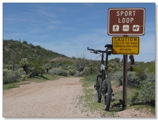
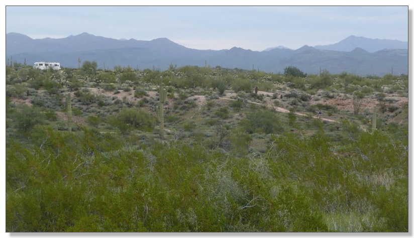
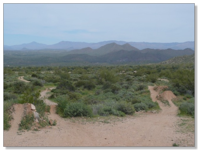
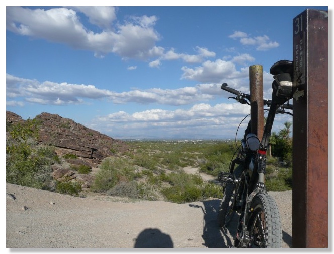
McDowell Competitive Tracks
The Competitive Tracks provided a welcome contrast to the "ADA" trails
elsewhere in McDowell. These are three loops in the lower part of the park
that have their own parking lot, but can be reached from the campground by
adding a 2 mile stretch of pavement. As the sign below says, these loops are
meant for "high speeds, challenging one's skills, and racing" and to please
"use trails for leisurely traveling". They're unidirectional, so you don't
have to worry (too much) about running into anybody and can just let 'er
rip, which is always nice:
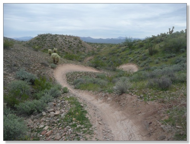
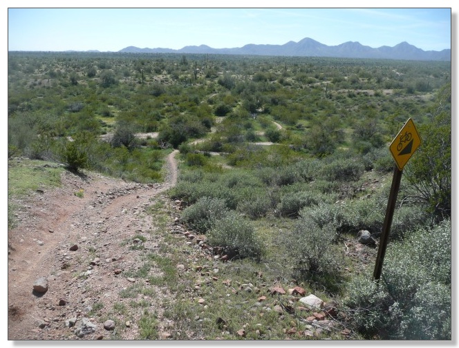
I rode all three loops. The "Long Loop" is about 8 miles abound and has
longer stretches of loose terrain than the others but is overall a good
example of quality, rolling desert singletrack. The "Technical Loop" is
hardly that, except for two short but steep drop-ins near the beginning and
one medium climb that's only "technical" in that it's covered with loose
rocks. My favorite was definitely the "Sport Loop" which was full of swoops
and dips and rode like a roller-coaster:
Highway-type signs warned of steep drops, which seemed a tad overblown. But
hey, safety first, I guess:
Here I go down the (not so) dreaded Double Dip--wheeee:
Later, I joined a peloton of clone riders. Geez guys, you're freaking me
out!

After a most pleasant week at McDowell, we parked the RV in the lower lot
and put in a few more laps around the Sport Loop on our way out of the park.
Below, Debbie grinds up the final climb, as our rolling home looms in the
parking lot. We used the showers there, which were almost as nice as the
ones in the campground, except for the bees. (TIP: never step on a
drowning bee with your bare feet):
Now, I am no bike racer, but I couldn't resist timing at least a few laps,
you know, just out of curiosity. My best time around the Sport Loop was
15:00, which, best I can tell, would put me near the front of the "11-12
year old male" category (which I reckon is appropriate given my "kid's"
bike--heh). I also did a back-to-back of the Sport Loop and the Long
Loop in 16:30+55:00. That one is harder to find a direct comparison to, but
it looks like that would put me a little over halfway down the field in the
"40-49 year old male beginner" category, which would be my real group.
Hmmmm... I think I'll stick with the XC endurance and adventure riding
on the bike, and leave the racing for the car.
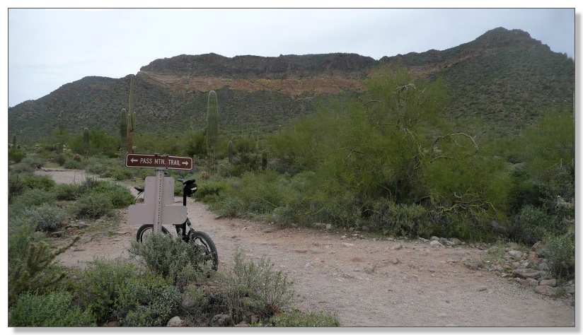
Usery Mountain Park
Speaking of adventure riding, our next stop was the Usery Mountain Regional
Park, home of the beloved Pass Mountain trail (beloved among mtbr forum
dwellers anyway--the county lists it as "not recommended for bikes"). The
Pass Mountain loop itself is fairly short at around 8 miles, but is quite
difficult throughout. It would be a pretty worthy destination ride all by
itself, but when combined with a few other trails in the area, this made for
one of the most scenic and interesting rides of our whole Arizona trip.
Highly recommended.
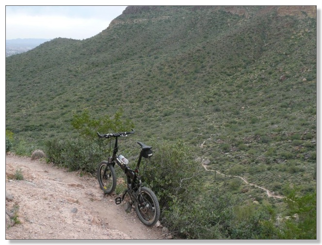
The general idea is to circumnavigate the extra-wide mountain below,
climbing to a high saddle on the backside then dropping back down and
closing the loop:
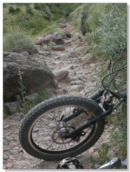
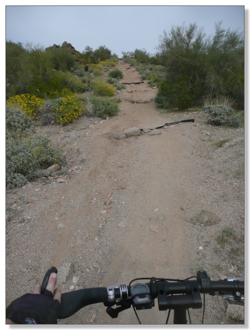
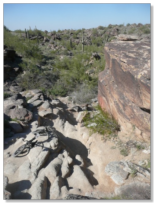
Several miles of rocky trail across the front side crawled painfully up and
down through wash after wash after wash:
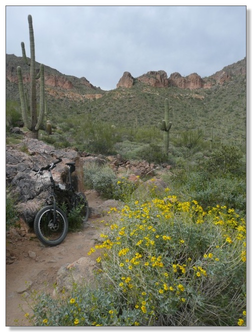
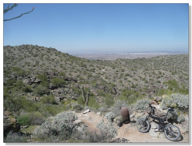
From the left shoulder of the mountain, some fantastic scenery came into
view to the backside:
Fanciful flower formations flourished:
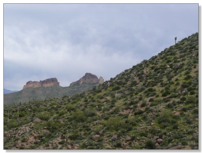
And a lone saguaro stood out against a stormy looking sky:
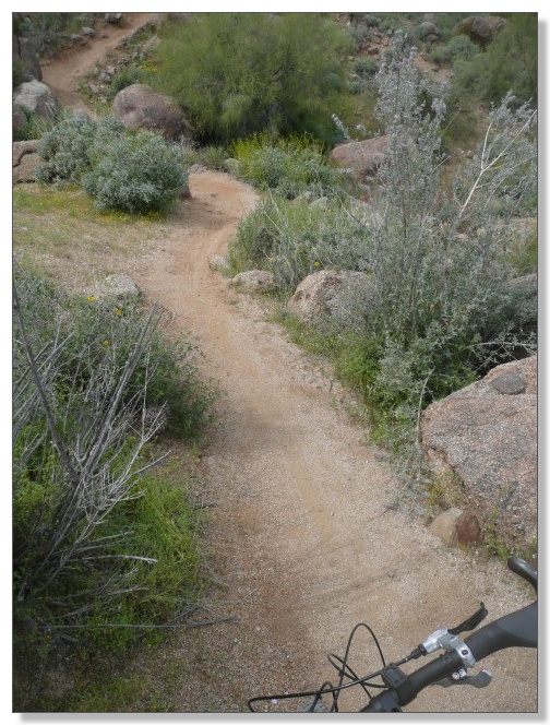
The long climb was mostly narrow, bench-cut singletrack that was often
challenging, often breathtaking, and almost always rideable. However, one
stretch grew too steep and chunky and I had to finally admit defeat and push
for a few hundred yards:
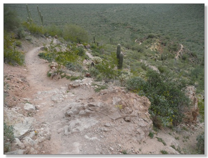
Eventually the backside saddle was gained, and the singletrack I was headed
for next appeared far below:
The trail positively plummets from the high point and heads down to a knob
which it wraps almost 270 degrees around. It's really cool:
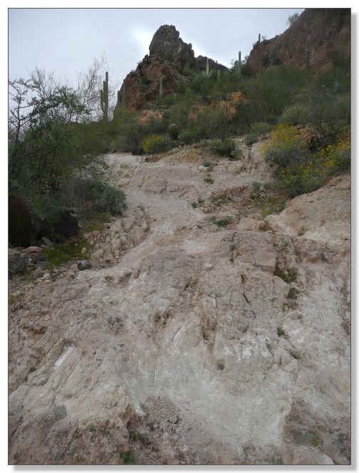
The super-steep chunky section below is undoubtedly the crux of the descent
and it surely has some colorful name. I'm also pretty sure it's great fun to
master for experienced "gnar" specialists on bikes with bigger wheels and/or
more suspension travel than mine, but I wanted to live to enjoy the rest of
this great trail, so I scrambled down with my rig, carefully:
Mighty fine, mighty fine:
The descent gradually flattened out and wrapped back around to the front of
the mountain, and the tread transitioned to loose babyheads for what seemed
like several miles. Normally quite frustrating on 20s, it was really a lot
of fun to be able to "power" through the darn things for a change thanks to
the slight downhill slope which helped me maintain momentum and keep my
undersized hoops turning.
A giant arrow on the mountain across the highway shows the way back to the
big city, so it's impossible to get lost (we'll see about that):

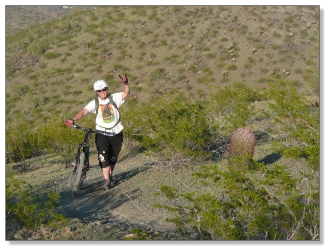
We stayed at Usery for almost a week and Debbie rode some too. One day we
decided to test the "impossible to get lost" claim by letting her navigate
solo. I gave her the map and just followed. Turned out to be a pretty
interesting ride, and since I'm here posting pics, you can conclude we found
our way back and the claim is therefore "confirmed":
Later in the week I set off across the highway on a big exploratory tour of
Hawes, and Debbie solo'ed the lower trails at Usery, including Moon Rock,
Blevins, and the like, which look something like this:
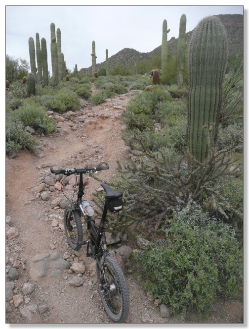
Hawes
Just a mile or so down the highway from Usery is an abandoned pit which has
been transformed into a freeride playground, complete with several lines of
jumps and numerous big drops into the pit. I rolled up to some armor-clad
guys on long-travel bikes who wondered if I was there to do some BMX-style
jumping with them. Heh, maybe next time. They pointed me toward the
trail around the pit that led into Hawes from the backside, and I was on my
way:
The Wild Horse trail turned into the Big Rock trail which turned into the
Twisted Sister trail. Despite the name changes, the trail was consistently
excellent. It was narrow, interesting, and slightly downhill most of the
way, which made for almost 5 miles of fast, swoopy, and utterly delightful
cross-country mountain biking:
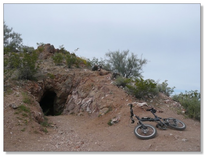
A series of steep switchbacks led up to an old mine on the aptly-named Mine
Trail. I made it past the shaft without falling in, and made it down the
other side of the mountain without falling off (not exactly a given given
how steep and narrow that descent was). Just after taking the photo below, I
heard a weird noise and turned around to see a massive swarm of bees heading
right for me. I ducked down and thousands of bees buzzed past me for a solid
minute or so. The air was thick with the little migrating devils, but lucky
for me, they must have just finished lunch and they left me alone. Crazy
stuff out here in the desert:
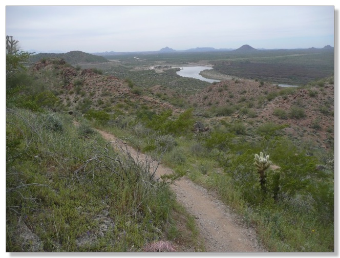
I was surprised to find that a giant reservoir had been hiding just over the
range from our desert hideaway at Usery:
At one point near the bottom, I had stopped to eat a Clif bar when the bees
showed up again! Had to be the same swarm, having made their way down from
the top of the mine. I hit the deck and hoped to stay under them again, but
this time a few took an interest in me and I had to do some swatting to get
'em off. Thankfully they weren't persistent and rejoined the swarm which
passed by a few inches overhead, but it was a scary few minutes, for sure.
I explored most of the "front" side of Hawes, including the Ridge, Saddle
Back, and Saguaro trails. A lot of good climbs with occasional technical
features to keep things interesting. The main trail up the hill here is
called Hawes and includes sections nicknamed Cardiac Hill and Mudflaps. Like
many things in mountain biking, it's easy to figure out why they got their
names. I was huffin' by the top, but was pleased to have made it up both
Cardiac and Mudflaps in one long continuous grind. To get back to Usery, I
needed to keep going all the way up the mountain and drop down the other
side. This route took me up through Upper Mudflaps, which proved seriously
steep and I had to push some of it:
The trail stayed really steep but also turned really rocky near the top as
the trail approached the microwave towers. I did a lot of pushing and
carrying of the bike through this part, and now understood why the few
people that ride this route at all usually do it in the other direction.
Also now understood why this bit of double-black trail is called the "Tower
Drop" rather than the "Tower Climb". Tough going!
Finally made it to the top and joined the paved maintenance road that leads
up to the towers, and cruised that down to the highway just across from
Usery park to conclude a nice 23 mile loop. If I were to do it again, I'd
probably take the long way back on the excellent singletrack of Twisted
Sister and such rather than pushing up the uber-gnarly tower drops, but hey,
I wanted to see what it was like for myself:
Whatever hung in the air to the west probably made for unpleasant breathing
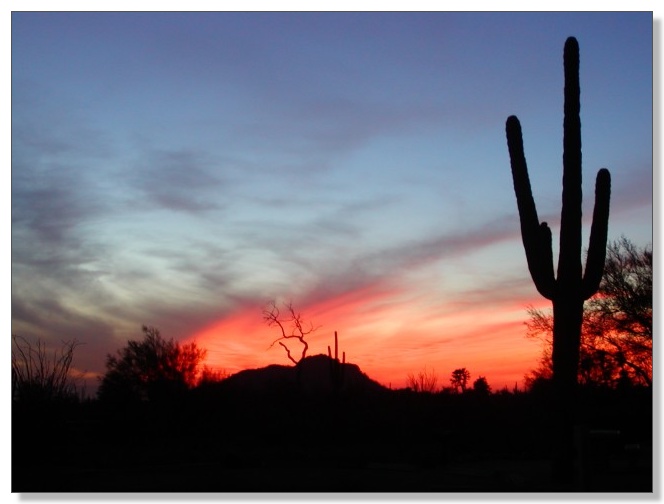
in Phoenix, but it definitely made for gorgeous sunsets from Usery:
Trail 100
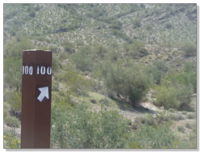
Made a trip into town one day and did a coast-to-coast tour of T-100. I
parked roughly in the middle at the Dreamy Draw trailhead, and did
out-and-backs to both ends, which made for just under 24 miles of riding:
Trail 100 itself is the generally-intermediate main artery through a 70-mile
network of trails located right in the heart of the Phoenix metro area.
There's apparently some seriously gnarly stuff available too if you stray a
bit off the mainline.
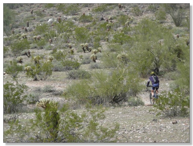
I met the guy above at a fork in the trail and we rode together for a while.
Like (I gather) many T-100 riders do, he lives nearby and rides before work
or during lunch or whenever a spare hour or few appears. While the T-100
network may not have a reputation as being a "destination ride" it's
definitely cool to have such long trails right in the middle of a big city:
South Mountain
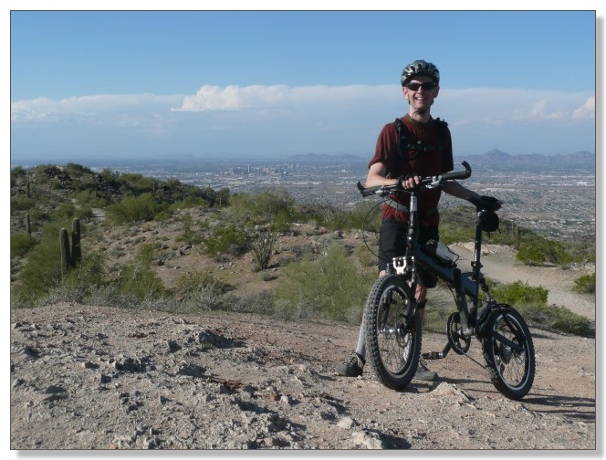
Speaking of "destination rides"... Yes, after almost two weeks, I finally
made my way down to the headliner of the Phoenix area, South Mountain. We
parked the RV at the new Lone Butte casino which was about as close as we
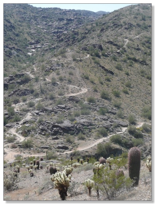
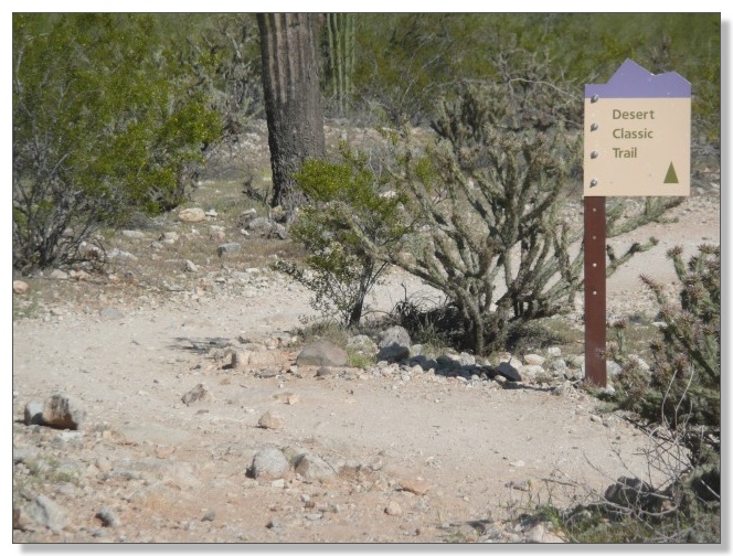
could stay to SoMo. I started off with a late-afternoon tour of Desert
Classic, a long, relatively-smooth out-and-back on the south skirt of the
mountain.
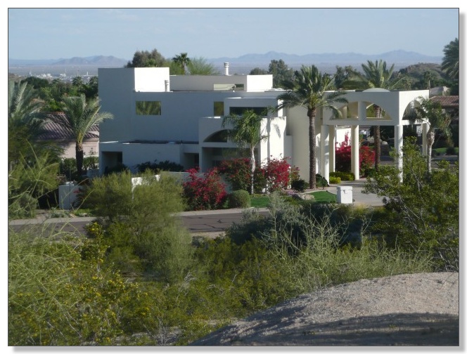
The trail adjoins a neighborhood full of swank houses, some of which look
more like resort hotels:
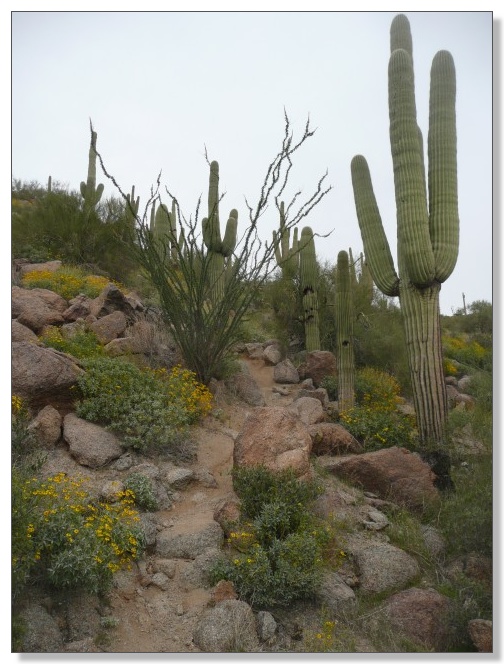
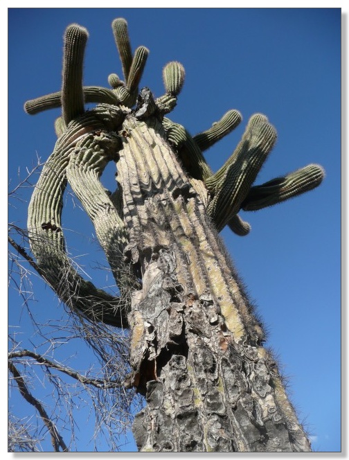
True to its name, the Desert Classic trail winds through classic desert
scenery, such as this particularly contorted saguaro:
While snapping the photo above, I was passed by a rider who said something
like "cute bike". I later caught up with him and his friend and we got to
talking. Turns out he was mtbr forum regular latedropbob who
organizes a popular Wednesday morning shuttle ride. He ended up taking pics
of me with my bike folded and unfolded for his blog:
Next thing I knew, I was tagging along on a "side loop" they had in mind,
which started with the Goat trail, a steep and loose fall-line type affair
which I suspect is more fun for can-eating animals than humans. I snuck past
Bob and made a pretty good charge up the rubble before finally losing it and
pushing the rest of the way. Here's Bob walking his big bike up behind me:
Bob had by now decided that my exploits needed to be captured on video and
shared with the world, so he rode ahead a bit and took a pretty good clip of
me zipping down a hill and starting the last climb up to the helipad. Click
the link to read his amusing blog entry
"That guy on
a 20" Folding Bike is kicking our A$$!!!" and/or click below to play
the video:
I chased him down the Helipad descent which was a sweet reward after that
nasty little climb, then rejoined DC for a bit, then split off to try the
so-called Secret trail he'd recommended, which was also pretty sweet. Came
across a guy a couple miles out with a flat tubeless tire. Tried to help him
get it reinstated but neither of us could get my pump to inject any
pressure, so he resolved to just continue walking it in, while I hustled up
and got in just before dark. An almost full moon that night should have
illuminated the trail pretty well, and hopefully he didn't get eaten by the
howling coyotes.
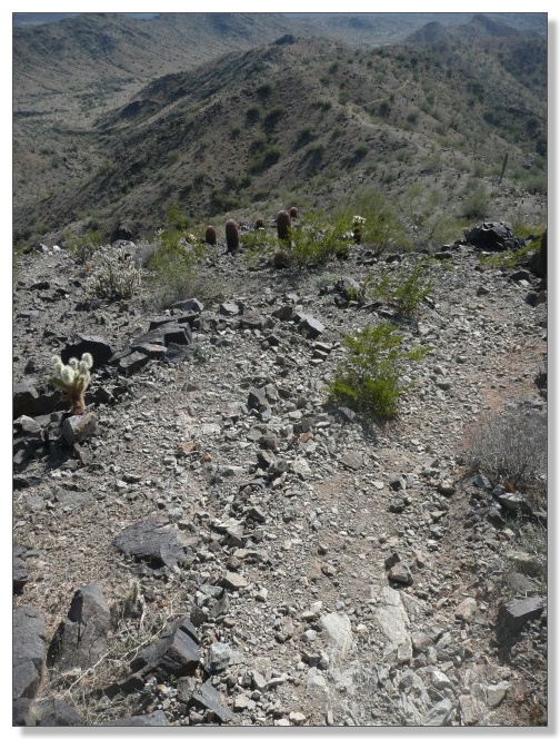
A day later, it was time to sample some of the "gnar" and "chunk" that SoMo
is internationally known for. I started with the classic climb up Mormon and
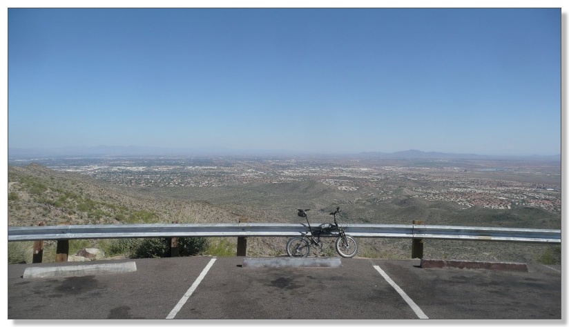
National to the Buena Vista overlook:

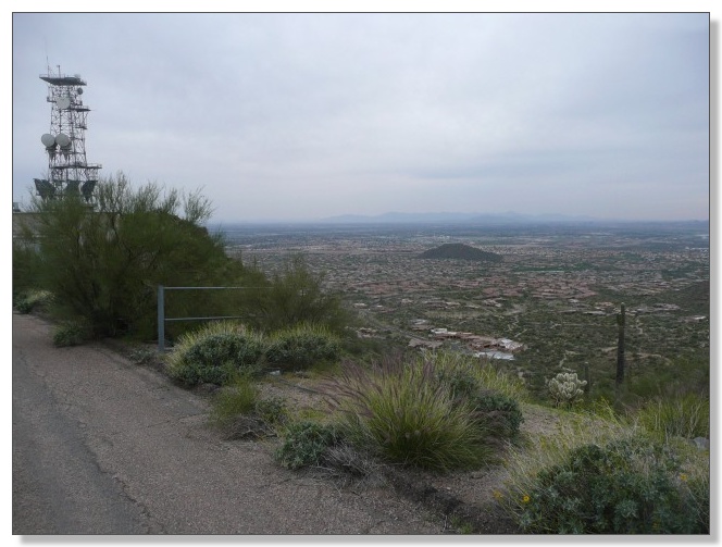
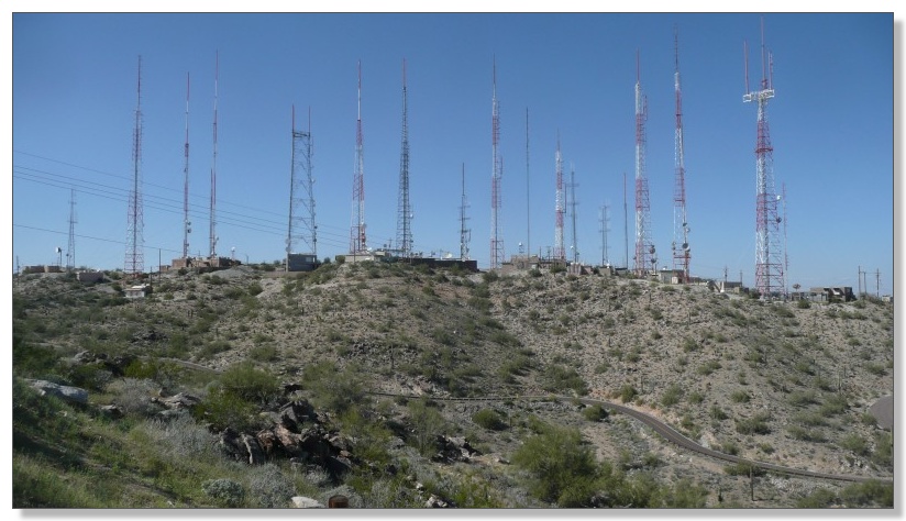
I took a little side trip by road from BV over to the TV towers overlook,
which offers big views of civilization to the south and east:
And this view of the amazing array of huge antenna towers up top that bathe
the millions below with entertaining radiation:
Sightseeing concluded, I bombed National all the way back down. Okay,
"bombed" is a bit of an exaggeration. I'm rollin' 20-inch wheels with less
than 3" of suspension travel after all. So the word "picked" is probably
more accurate. Well, and "carried" applies too, for a few bits, including
the famous waterfall below:
From reading about National, I had my doubts about whether I'd be able to
ride much of it on my bike, but, except for a few really nasty sections, the
majority of it was rideable and in fact fantastic fun on the little bike.
Definitely one of those trails that lives up to the hype:
For my next outing at SoMo I wanted to explore the less-traveled western
half of the National Trail. Debbie kindly shuttled me up to the Buena Vista
trailhead and I rode off to the west. This side of National has a lot
different feel to it than the east side, as it traces the long, long South
Mountain ridgeline for miles. I had barely hopped back on the bike after
snapping the picture below (showing downtown) when one of the grips slid off
and came off in my hand--whoops! Apparently I need to re-torque the bolts
even more often when riding this much rock, but anyway...
No problem. I'll just slide it back on, snug it up, and be back on my way.
Problem. I had somehow lost the little set of Allen wrenches I normally
carry and I couldn't find anything else that would turn that bolt. These
newfangled bolt-on grips are wonderfully secure compared to the
old-fashioned friction-fit rubber grips that used to slide off in my hands
anytime it rained, but if that bolt ever comes loose, you're doomed. I now
have firsthand knowledge that a bike with a bare aluminum handlebar is,
surprisingly, virtually un-rideable offroad, It's amazing what a difference
little things make sometimes:
So, I threw all the grip parts in my pack and retraced back to the road.
Rode from overlook to overlook hoping to find Debbie or anybody with some
tools, but came up empty, until my second trip back up to Buena Vista. Trent
was a new mtb'er, but a smart one, as he was lugging around a nice big Allen
tool in his pack. After getting my grip re-attached, I thanked Trent
profusely and retraced the road to pick up where I left off about an hour
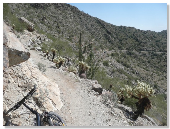
before, including this gnarly narrow traverse cut in high above the road:
After a while, the trail crossed the highway then resumed with a wicked
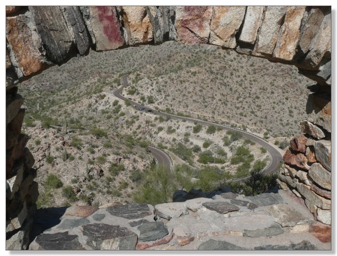
hike-a-bike up to an old stone tower:
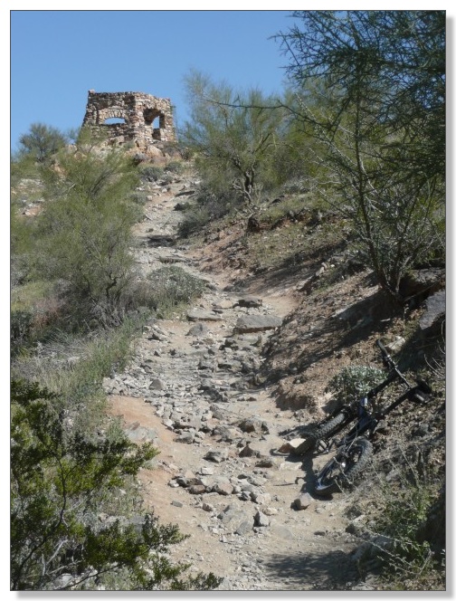
The tower offered 360-degree views out four stone windows, including a peek
at the even-more-wicked hike-a-bike up to the top of the ridge to the west,
and the view below of the winding road:
The parts of National West that aren't crazy-steep hike-a-bike are often
bench cut goodness, and are a welcome complement to the downhill gnar-fest
that is the more popular half.
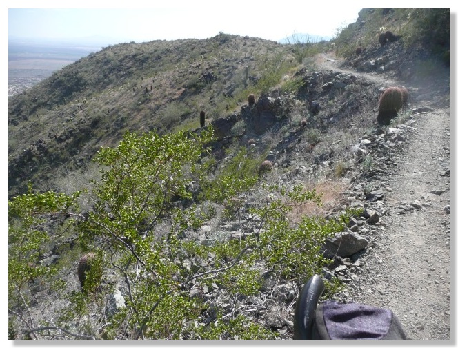
There's beautiful scenery back here too, with hardly anybody else to have to
share it with (if you dislike sharing such things):
After about five miles of amazingly slow crawling up, down, and along the
neverending ridgeline, the trail finally turned down for good, in the form
of a super-loose scree slope that plummets straight down several hundred
feet of vertical. This was a wild ride! Not particularly rewarding, mind
you, but plenty wild. I got off and slid down several parts of it on foot
that were too sketchy for me to even attempt on wheels:
After that nuclear descent the trail mellowed to a flat cruiser that
connected over to the park road, which was closed to cars and was actually
not a bad way to wrap up this ride. Debbie picked me up at the end almost
four hours after dropping me off at the top, which seems a positively
ridiculous amount of time to cover barely 10 miles of singletrack. Of course
that includes a lot of fooling around at the beginning due to the Great
Unbolting Grip Disaster and the multiple hike-a-bikes along the ridge and
general slow going, but still, this was one of those rides where you just
wonder where all the time went! Really enjoyed the exploratory nature of
this ride though, despite the vexations.
My final day at SoMo turned into a doozy. It started with lunch with Debbie
at Los Dos Molinos. Gotta say that while super-spicy enchiladas topped with
a fried egg sure sounds like ideal pre-ride fuel, I remain unconvinced. I
tried it twice just to make sure, but unfortunately, it seems to put me into
a total food coma for a good two hours. That's not a great thing when your
planned ride starts at the 46th Street trailhead with stiff climbs up
Javelina and Ridgeline. Oh well, up I went, sluggish beyond imagination but
I eventually topped out on Ridgeline and was rewarded with this cool view
across the valley, of National winding its way down:
I scrambled down Ridgeline, which seemed seriously steep and sketchy (but
maybe it was just my enchilada-poisoned muscles wigging me out). Carried on
around the West and East Loops past the golf course and picked up Desert
Classic at its origin. Side-tripped through some Flats trails, powered up
the Secret trail, then rejoined DC and took it all the way to the end:
I didn't really have a plan for how this ride was gonna end, so I just kept
going past the end of DC as it transitioned into the Telegraph Trail. The
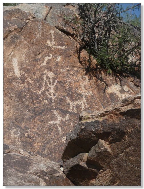
riding stayed mellow up to a petroglyph panel:
Above that, the trail turned to impassibly steep rock, but I was surprised
at just how close I was to Telegraph Pass. By this time the enchilada-effect
had worn off and I was feeling strong. It would only be maybe a 1/2 mile
hike-a-bike (which occasionally devolved into carry-a-bike) to reach the
pass, so I picked her up and joined all the other hikers scrambling up and
down this thing. For some reason though, none of them were carrying bikes.
Oh well, their loss!
I popped out at the Telegraph overlook and chatted with a couple of
mountain-biking park rangers who were resting on the bench. One thing led to
another and they told me about some local guy who rides a full-on 20-inch
wheeled rigid singlespeed BMX bike for the annual National
coast-to-coast-to-coast ride. Made me feel like a real softie for rolling
20s with all my gears and suspension (not to mention a seat at a proper
height). Tough as a mighty saguaro, that guy.
Took the road up to BV and "bombed" down National, Mormon, and Javelina to
close a big, unusual lollipop loop of just under 24 miles. Adios, SoMo! You
tried to kill me, but I got the last laugh (a satisfied grin anyway).
So that wraps up my recap of our stay in the Phoenix area. As you can tell,
I sure had a great time! Still left to share are highlights from a day up
north on the Black Canyon Trail, and a week down south at Casa Grande, the
50-Year Trail, the AZ Trail at Vail, Starr Pass/Tucson Mountain Park,
Fantasy Island, and the grand finale, the Kentucky Camp IMBA Epic. Stay
tuned!
< previous story home next story >
HOME TRAVEL LOG MOUNTAIN BIKING WINDSURFING STORY ARCHIVES RV INFO PHOTOS CONTACT US